Tegal, Jateng
Slamet via Guci
Fairly busy
81 hikers viewed this trail in the last 7 days
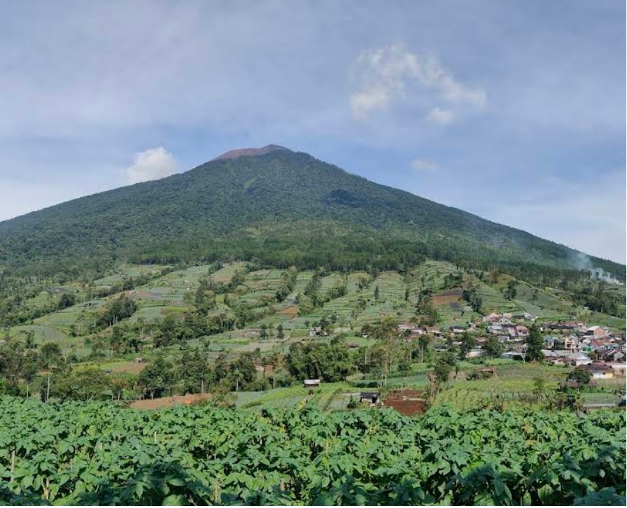
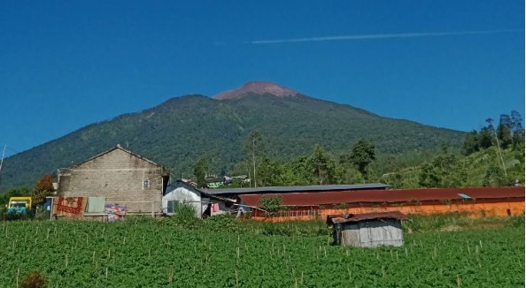
The hiking trail of Mount Slamet via Guci, Tegal, is one of the favorite routes because it offers stunning natural scenery and relatively good accessibility. This trail is approximately 10 km long with an average travel time of 7-10 hours, depending on the hiker's physical condition and weather. The hiking post starts at an altitude of around 1,300 meters above sea level, passing through several posts such as Pos Kalipagu, Pos Bengkok, and Pos Cemara until reaching the summit at an altitude of 3,428 meters above sea level. The hiking terrain varies, ranging from relatively flat earth trails to steep rocky climbs near the summit. The vegetation along the trail is dominated by dense tropical forests at the beginning of the journey, which then changes to mountainous shrubs at higher elevations. This trail also offers beautiful panoramas in the form of green valleys, natural springs, and cool air, making it a challenging yet satisfying hiking experience.
Hiking Trail Suitable For Expert
Statistics
- Elevation Gain
- 2101m
-
Total Distance
The value shown is the total ASCENDING distance
- 9.95km
-
Travel Time
This travel time is the time taken for the ASCENDING journey only and does not account for rest stops along the way or overnight stays
- 6.4hours
-
Calories
The value shown is the calories used for ASCENDING and DESCENDING journeys, excluding calories needed during rest stops along the hike or for overnight stays
- kcal
Map & route
View the route
Trail waypoints
Every point along the trail
-
01
Basecamp Guci
Elev 1219 m -
02
Pos 4
Pos ini dilengkapi dengan fasilitas seperti air bersih, musala, dan MCK, sehingga menjadi lokasi populer bagi pendaki untuk bermalam
Elev 2438 m Duration 3.3 hours Calories 2,225 kcal -
03
Pos 5
Dikenal sebagai Pondok Cantigi atau Plawangan, pos ini juga sering dijadikan tempat berkemah sebelum melanjutkan pendakian ke puncak
Elev 2868 m Duration 4.6 hours Calories 3,195 kcal -
04Elev 3320 m Duration 6.4 hours Calories 4,355 kcal
-
See full segmentation
Elevation profile, distance & time for each segment
Weather Conditions
Forecast at official points
Basecamp Guci
1,219 m
Tuesday
21 July · 13:00

Fog
23 °C
1.9 km/h
Wednesday
22 July · 13:00
Fog
23 °C
3.0 km/h
Thursday
23 July · 13:00

Cloudy
23 °C
1.8 km/h
ⓘ The weather conditions above are data from Open Meteo
See 7-day forecastInformation
Details you need to know
- Hikers can start their journey from the Gupala Basecamp or the Kompak Basecamp, providing flexibility in planning the hike.
- The total hiking time to the summit can reach around 10 hours, with relatively long distances between posts.
- This trail is known to be challenging, with a combination of steep terrain, rocky trails, and long climbs.
- The Guci trail is less crowded compared to other trails like Bambangan, providing a more peaceful and natural hiking experience.
- Around Guci Village, there are natural hot springs that can be enjoyed before or after hiking to relieve fatigue.
- Although there are sources of clean water at several posts, such as Post 4 which has access to clean water and toilet facilities, hikers are advised to bring sufficient water supplies from the start of the hike to ensure their needs are met during the journey.
- This trail offers beautiful green valley panoramas, tropical forests, and mountainous scenery.
- The entire Mount Slamet hiking trail is temporarily closed due to landslides and flash floods (28-01-2026)
- Prohibition of Making Campfires: Hikers are prohibited from making campfires during the hike to prevent the risk of forest fires.
- Bringing liquor and narcotics during the hike is strictly prohibited, considering Mount Slamet is considered a sacred place that needs to be preserved.
- Hikers are required to maintain cleanliness by not littering and to preserve the natural beauty of the mountain environment.
- There are no significant reports of wild animals on the Guci hiking trail. However, hikers must still be vigilant and maintain cleanliness, not leaving food residue that can attract wildlife.
ⓘ Last updated on Jumat, 3 Juli 2026
Hiker Reviews
Stories from other hikers
100%
recommend · 4 hikers
Weather forecast
—
No data yet
Trail info
—
No data yet
Water source
—
No data yet
No Reviews Yet
Be the first to share your experience and review this hiking trail!
Error!
An error occurred while fetching reviews for this hiking trail.
Other routes
Other routes on Slamet

162
100%
(5)
Popular
Kutabawa, Purbalingga, Jateng
Slamet via Bambangan
- Elev
- 3,432m
- Distance
- 6.2 km
- Duration
- 6.8 hours

61
100%
(5)
Fairly busy
Trending
Ketenger, Banyumas, Jateng
Slamet via Baturraden
- Elev
- 3,432m
- Distance
- 7.6 km
- Duration
- 9.3 hours