Purbalingga, Jateng
Slamet via Bambangan
Popular
162 hikers viewed this trail in the last 7 days
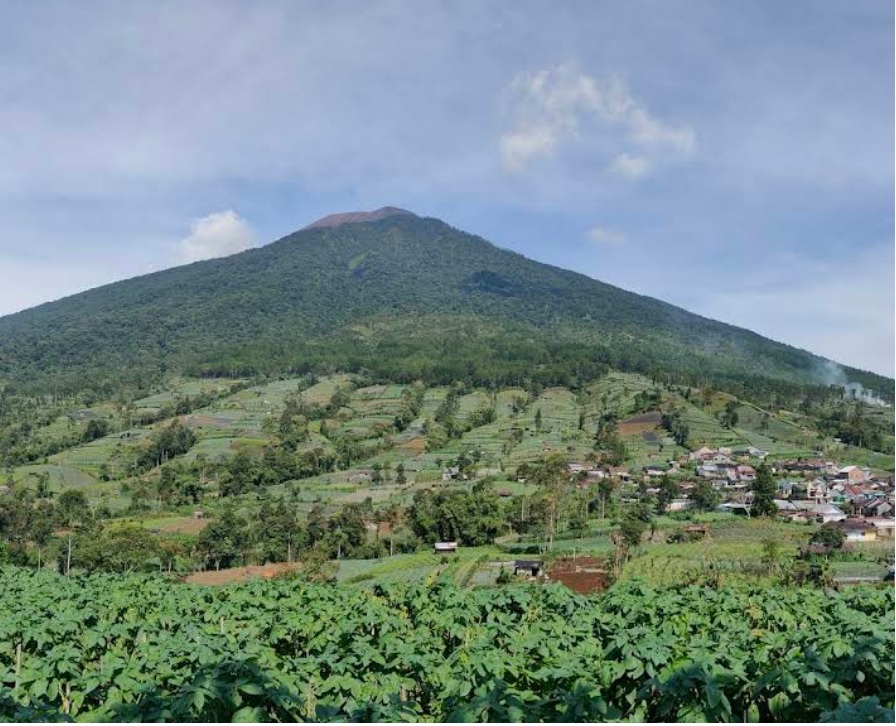
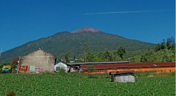
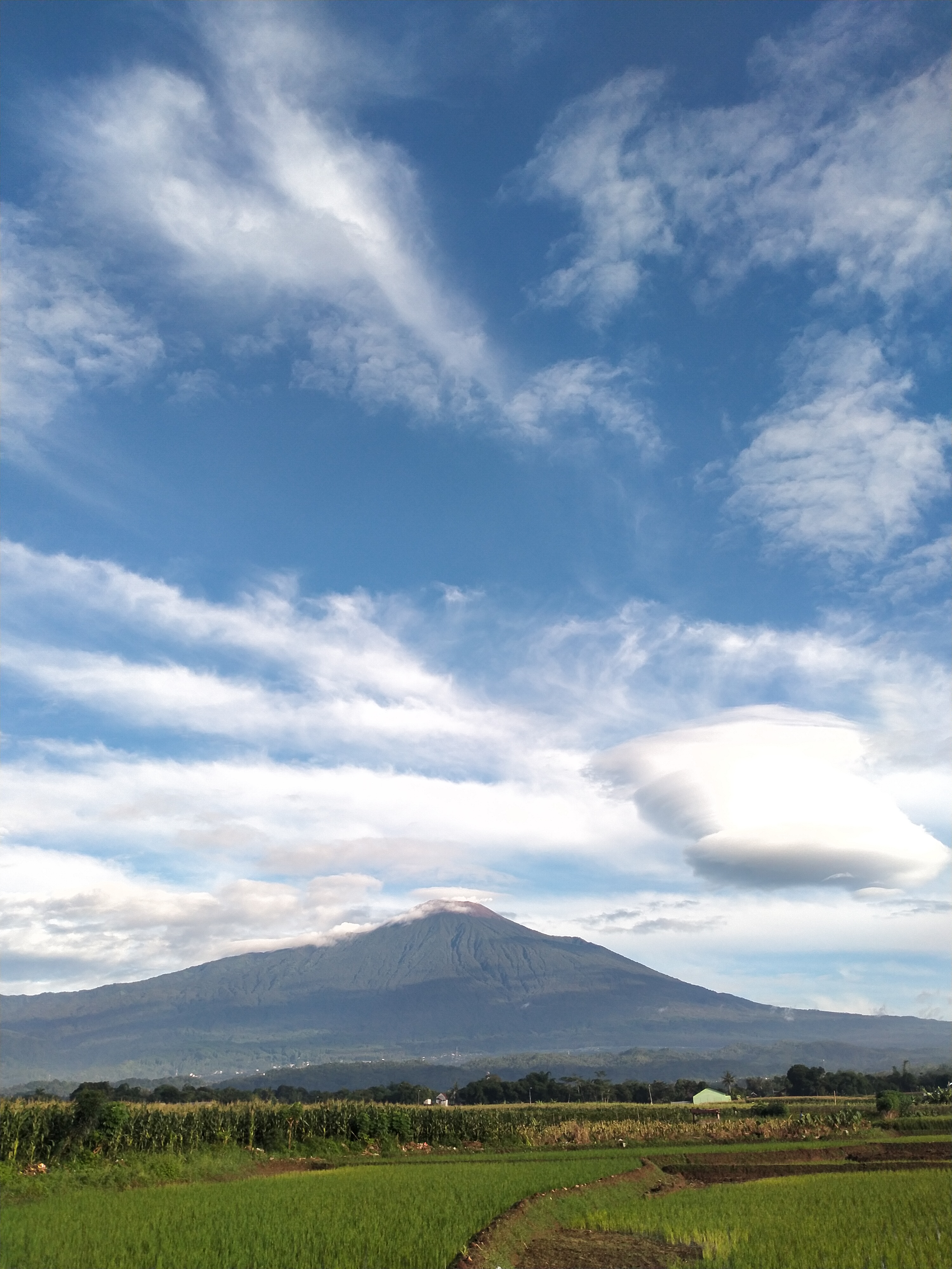
The Bambangan route to Mount Slamet in Purbalingga has a length of approximately 7 km, with an ascent time of 8-12 hours and a descent time of 5-7 hours. Starting from the base camp at an altitude of ±1,480 meters above sea level, hikers pass through 9 main posts to reach the summit at 3,428 meters above sea level. The initial route is relatively gentle with tropical forest vegetation, but from Post 3, the incline becomes steeper, rockier, and more challenging above Post 7 to the volcanic rock zone towards the summit. With an average slope of 30-45 degrees, this route demands good stamina, especially when facing strong winds and low temperatures down to 5°C at the summit. Along the way, hikers are treated to the beauty of dense forests, green valleys, and panoramic views of other mountains such as Merapi, Merbabu, Sindoro, and Ciremai. Basic facilities are available at the Bambangan Basecamp, and this route often becomes a favorite due to its accessibility, although it remains challenging for intermediate to advanced hikers.
Hiking Trail Suitable For Expert
Statistics
- Elevation Gain
- 1931m
-
Total Distance
The value shown is the total ASCENDING distance
- 6.20km
-
Travel Time
This travel time is the time taken for the ASCENDING journey only and does not account for rest stops along the way or overnight stays
- 6.8hours
-
Calories
The value shown is the calories used for ASCENDING and DESCENDING journeys, excluding calories needed during rest stops along the hike or for overnight stays
- kcal
Map & route
View the route
Trail waypoints
Every point along the trail
-
01
Basecamp
Elev 1485 m -
02
Pos 4 (Samaranthu)
Elev 2684 m Duration 3.8 hours Calories 2,716 kcal -
03
Puncak
Elev 3416 m Duration 6.8 hours Calories 4,595 kcal -
See full segmentation
Elevation profile, distance & time for each segment
Weather Conditions
Forecast at official points
Basecamp
1,485 m
Tuesday
21 July · 13:00

Fog
20 °C
5.2 km/h
Wednesday
22 July · 13:00

Light Rain
19 °C
6.7 km/h
Thursday
23 July · 13:00
Fog
18 °C
10.6 km/h
ⓘ The weather conditions above are data from Open Meteo
See 7-day forecastInformation
Details you need to know
- Hiking on this route: OPEN (20-01-25).
- Mount Slamet Level II (Alert) (20-01-25).
- There is no new information related to increased volcanic activity through this route (20-01-25).
- The Bambangan route to Mount Slamet has a water source around Post 2, but this water source is not always available throughout the year, especially during the dry season, so hikers are advised to bring sufficient water supplies from the base camp.
- For overnight stays, the recommended location is Post 4 (Samaranthu), as it has a fairly wide flat area and is protected from the wind. Post 7 is also an option, although its capacity is limited and the wind is stronger.
- Food stalls are usually only available around the base camp, so hikers need to prepare their own supplies for the route above. Mature logistical planning is crucial, given the lack of additional facilities at higher altitudes after Post 2.
- The entire Mount Slamet hiking route is officially closed temporarily following a landslide and flash flood disaster (28-01-2026)
- There are no new prohibitions related to hiking and volcanic activities on this route (20-01-25).
- All hikers must register at the Bambangan Basecamp by submitting their identity and filling out a hiking form.
- There is a daily quota limit to prevent overcapacity, especially during holiday seasons.
- Hikers are required to bring standard equipment, including thick jackets, flashlights, first aid kits, and tents.
- All trash brought must be taken back down. Hikers are advised to bring their own trash bags.
- Solo hikers must report specifically and are recommended to hike in pairs for safety.
- Leaving trash along the route or at the summit is strictly prohibited.
- Lighting campfires is prohibited above Post 1 to prevent forest fires.
- Hikers are not allowed to pick plants or damage vegetation along the route.
- Alcohol and narcotics are not permitted to maintain safety and order.
- All commercial activities, such as content creation or promotions, require special permission from the manager.
- Engaging in hiking outside the official route or beyond safe limits, such as dangerous areas at the summit crater, is strictly prohibited due to safety risks.
ⓘ Last updated on Jumat, 3 Juli 2026
Hiker Reviews
Stories from other hikers
100%
recommend · 5 hikers
Weather forecast
—
No data yet
Trail info
—
No data yet
Water source
—
No data yet
No Reviews Yet
Be the first to share your experience and review this hiking trail!
Error!
An error occurred while fetching reviews for this hiking trail.
Other routes
Other routes on Slamet

61
100%
(5)
Fairly busy
Trending
Ketenger, Banyumas, Jateng
Slamet via Baturraden
- Elev
- 3,432m
- Distance
- 7.6 km
- Duration
- 9.3 hours
81
100%
(4)
Fairly busy
Guci, Tegal, Jateng
Slamet via Guci
- Elev
- 3,432m
- Distance
- 10.0 km
- Duration
- 6.4 hours