Karanganyar, Jateng
Lawu via Cemoro Kandang
Fairly busy
66 hikers viewed this trail in the last 7 days
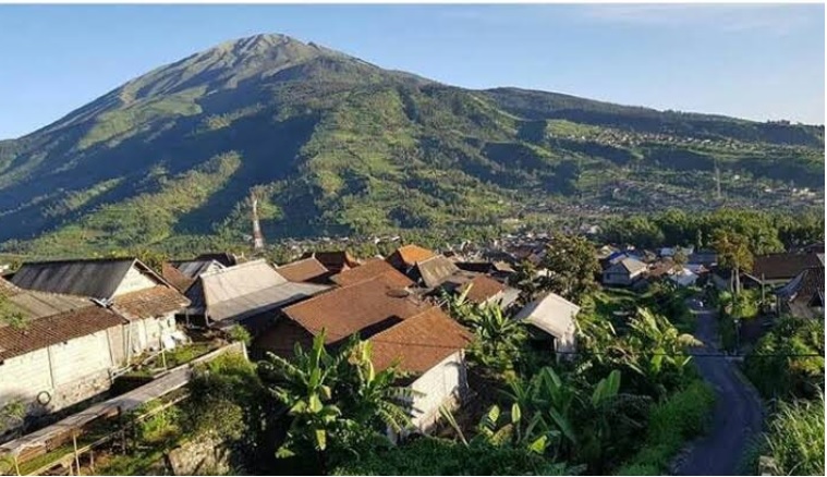
Favorite route Photo: Rajulan Ahmad Rajih (googlemap - September 2020)
Hiking Trail Suitable For Intermediate
Statistics
- Elevation Gain
- 1329m
-
Total Distance
The value shown is the total ASCENDING distance
- 8.73km
-
Travel Time
This travel time is the time taken for the ASCENDING journey only and does not account for rest stops along the way or overnight stays
- 5.9hours
-
Calories
The value shown is the calories used for ASCENDING and DESCENDING journeys, excluding calories needed during rest stops along the hike or for overnight stays
- kcal
Map & route
View the route
Trail waypoints
Every point along the trail
-
01
Basecamp Cemoro Kandang
Jalur favorit
Elev 1958 m -
02
Puncak
Elev 3287 m Duration 5.9 hours Calories 3,413 kcal -
See full segmentation
Elevation profile, distance & time for each segment
Weather Conditions
Forecast at official points
Basecamp Cemoro Kandang
1,958 m
Tuesday
21 July · 13:00

Fog
18 °C
2.3 km/h
Wednesday
22 July · 13:00

Light Rain
19 °C
3.2 km/h
Thursday
23 July · 13:00
Fog
15 °C
6.5 km/h
ⓘ The weather conditions above are data from Open Meteo
See 7-day forecastInformation
Details you need to know
- There is information stating that the main water source is Sendang Panguripan, which is located between Post 3 and Post 4. However, it should be noted that during the long dry season, this water source can dry up. (01-07-2025)
- The Lawu Mountain hiking trail in Karanganyar Regency will be closed for one month in February 2026 (27-01-2026)
- Open trip with more than seven people must be accompanied by a local guide.
- Hikers must register one day before the hike.
- Trekking must be done by at least two people
- Hikers are required to start descending no later than 13.00 WIB from any position on the hiking trail.
- To improve supervision, he added that the manager requires solo hikers to install the Strava application so that the hiker's position can be monitored during the trip.
ⓘ Last updated on Jumat, 3 Juli 2026
Hiker Reviews
Stories from other hikers
100%
recommend · 2 hikers
Weather forecast
—
No data yet
Trail info
—
No data yet
Water source
—
No data yet
No Reviews Yet
Be the first to share your experience and review this hiking trail!
Error!
An error occurred while fetching reviews for this hiking trail.
Other routes