Peniron, Kec. Pejagoan - Kebumen, Indonesia
Brujul (Geosite) via Pejagoan
9 hikers viewed this trail in the last 7 days
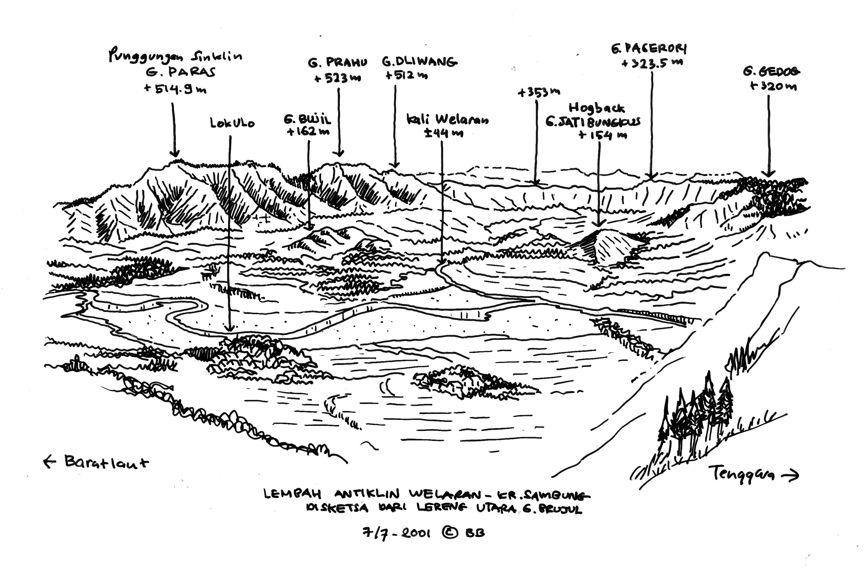
A spot to view the Karangsambang Amphitheater from the south side. The peak is composed of volcanic breccia from the Waturanda Formation.
Hiking Trail Suitable For Beginner
Statistics
- Elevation Gain
- 241m
-
Total Distance
The value shown is the total ASCENDING distance
- 1.17km
-
Travel Time
This travel time is the time taken for the ASCENDING journey only and does not account for rest stops along the way or overnight stays
- 3.7hours
-
Calories
The value shown is the calories used for ASCENDING and DESCENDING journeys, excluding calories needed during rest stops along the hike or for overnight stays
- kcal
Map & route
View the route
Trail waypoints
Every point along the trail
-
01
Basecamp
Elev 219 m -
02

Puncak Brujul
Elev 460 m Duration 3.7 hours Calories 1,552 kcal -
See full segmentation
Elevation profile, distance & time for each segment
Weather Conditions
Forecast at official points
Basecamp
219 m
Sunday
2 August · 13:00

Cloudy
27 °C
16.7 km/h
Monday
3 August · 13:00
Clear
29 °C
11.8 km/h
Tuesday
4 August · 13:00
Clear
29 °C
13.1 km/h
ⓘ The weather conditions above are data from Open Meteo
See 7-day forecastInformation
Details you need to know
The route passes through a natural forest and is relatively flat, but the upper part has a very steep slope, so it uses the available rope assistance. The peak also has a narrow area, so be careful when you're at the top.
ⓘ Last updated on Sabtu, 25 April 2026
Hiker Reviews
Stories from other hikers
0%
recommend · 0 hikers
Weather forecast
—
No data yet
Trail info
—
No data yet
Water source
—
No data yet
No Reviews Yet
Be the first to share your experience and review this hiking trail!
Error!
An error occurred while fetching reviews for this hiking trail.