Maluku Tengah, Maluku
Salahutu via Waai
8 hikers viewed this trail in the last 7 days
Jalur wisata
Hiking Trail Suitable For Beginner
Statistics
- Elevation Gain
- 855m
-
Total Distance
The value shown is the total ASCENDING distance
- 5.39km
-
Travel Time
This travel time is the time taken for the ASCENDING journey only and does not account for rest stops along the way or overnight stays
- 3.5hours
-
Calories
The value shown is the calories used for ASCENDING and DESCENDING journeys, excluding calories needed during rest stops along the hike or for overnight stays
- kcal
Map & route
View the route
Trail waypoints
Every point along the trail
-
01
Titik awal pendakian
Jalur wisata Desa Waai
Elev 135 m -
02
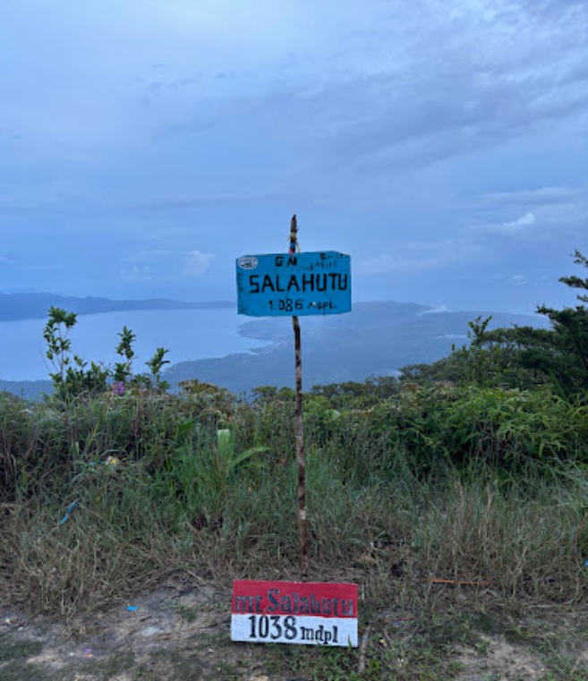
Puncak
Foto: google maps (YuNas - November 2024)
Elev 990 m Duration 3.5 hours Calories 2,232 kcal -
See full segmentation
Elevation profile, distance & time for each segment
Weather Conditions
Forecast at official points
Titik awal pendakian
135 m
Thursday
23 July · 13:00

Fog
27 °C
22.3 km/h
Friday
24 July · 13:00
Fog
27 °C
20.4 km/h
Saturday
25 July · 13:00
Clear
27 °C
22.8 km/h
ⓘ The weather conditions above are data from Open Meteo
See 7-day forecastInformation
Details you need to know
- Status jalur pendakian : DIBUKA (25-01-25)
- Per-hari ini tidak ada informasi baru tentang aktifitas pendakian melalui jalur ini (25-01-25)
- Informasi Sumber air pada jalur pendakian Gunung Salahutu via Waai terletak di Sungai Waai Tasoi. Sungai ini merupakan titik terakhir sumber air yang bisa ditemukan dalam perjalanan mendaki (03-07-2025)
- Per-hari ini tidak ada larangan baru yang berhubungan dengan aktifitas pendakian melalui jalur ini (25-01-25).
ⓘ Last updated on Sabtu, 2 Agustus 2025
Hiker Reviews
Stories from other hikers
0%
recommend · 0 hikers
Weather forecast
—
No data yet
Trail info
—
No data yet
Water source
—
No data yet
No Reviews Yet
Be the first to share your experience and review this hiking trail!
Error!
An error occurred while fetching reviews for this hiking trail.