Enrekang, Sulawesi Selatan
Latimojong via Karangan
21 hikers viewed this trail in the last 7 days
Favorite route
Hiking Trail Suitable For Expert
Statistics
- Elevation Gain
- 1939m
-
Total Distance
The value shown is the total ASCENDING distance
- 8.84km
-
Travel Time
This travel time is the time taken for the ASCENDING journey only and does not account for rest stops along the way or overnight stays
- 8.3hours
-
Calories
The value shown is the calories used for ASCENDING and DESCENDING journeys, excluding calories needed during rest stops along the hike or for overnight stays
- kcal
Map & route
View the route
Trail waypoints
Every point along the trail
-
01
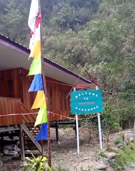
Basecamp Karangan
Jalur favorit Foto: google (Muhammad Risal - 2023)
Elev 1451 m -
02
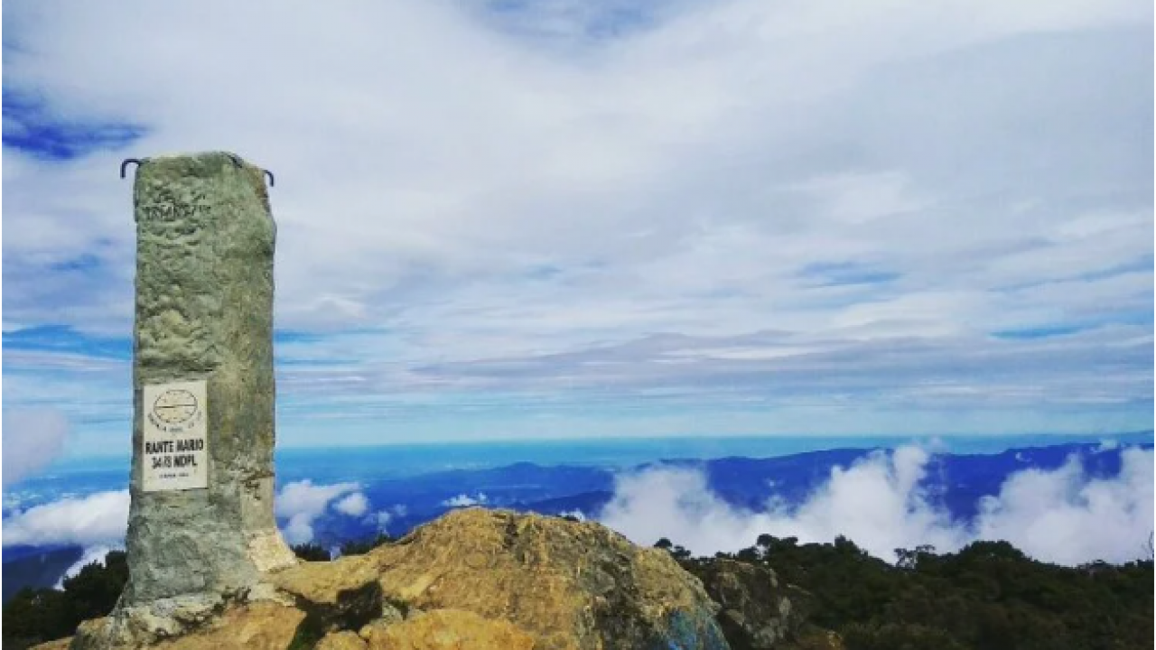
Puncak Latimojong
Foto: https://banti.digitaldesa.id/wisata/gunung-latimojong
Elev 3390 m Duration 8.3 hours Calories 5,022 kcal -
See full segmentation
Elevation profile, distance & time for each segment
Weather Conditions
Forecast at official points
Basecamp Karangan
1,451 m
Wednesday
22 July · 13:00

Fog
21 °C
11.6 km/h
Thursday
23 July · 13:00
Fog
20 °C
12.3 km/h
Friday
24 July · 13:00
Fog
20 °C
11.1 km/h
ⓘ The weather conditions above are data from Open Meteo
See 7-day forecastInformation
Details you need to know
none at this time
none at this time
ⓘ Last updated on Senin, 9 Maret 2026
Hiker Reviews
Stories from other hikers
0%
recommend · 0 hikers
Weather forecast
—
No data yet
Trail info
—
No data yet
Water source
—
No data yet
No Reviews Yet
Be the first to share your experience and review this hiking trail!
Error!
An error occurred while fetching reviews for this hiking trail.