Majalengka, Jabar
Ciremai via Apuy
Popular
184 hikers viewed this trail in the last 7 days
The most popular route
Hiking Trail Suitable For Intermediate
Statistics
- Elevation Gain
- 1652m
-
Total Distance
The value shown is the total ASCENDING distance
- 8.99km
-
Travel Time
This travel time is the time taken for the ASCENDING journey only and does not account for rest stops along the way or overnight stays
- 5.6hours
-
Calories
The value shown is the calories used for ASCENDING and DESCENDING journeys, excluding calories needed during rest stops along the hike or for overnight stays
- kcal
Map & route
View the route
Trail waypoints
Every point along the trail
-
01
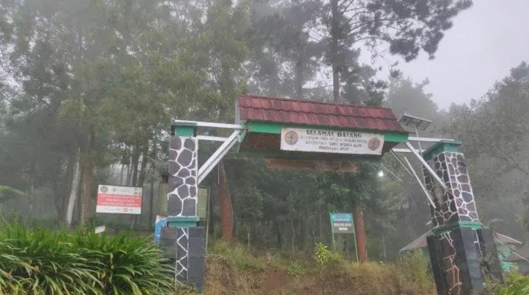
Apuy
Basecamp jalur favorit Foto: https://fajarcirebon.com/jalur-pendakian-apuy-gunung-ciremai-dibuka-untuk-rayakan-tahun-baru/
Elev 1166 m -
02
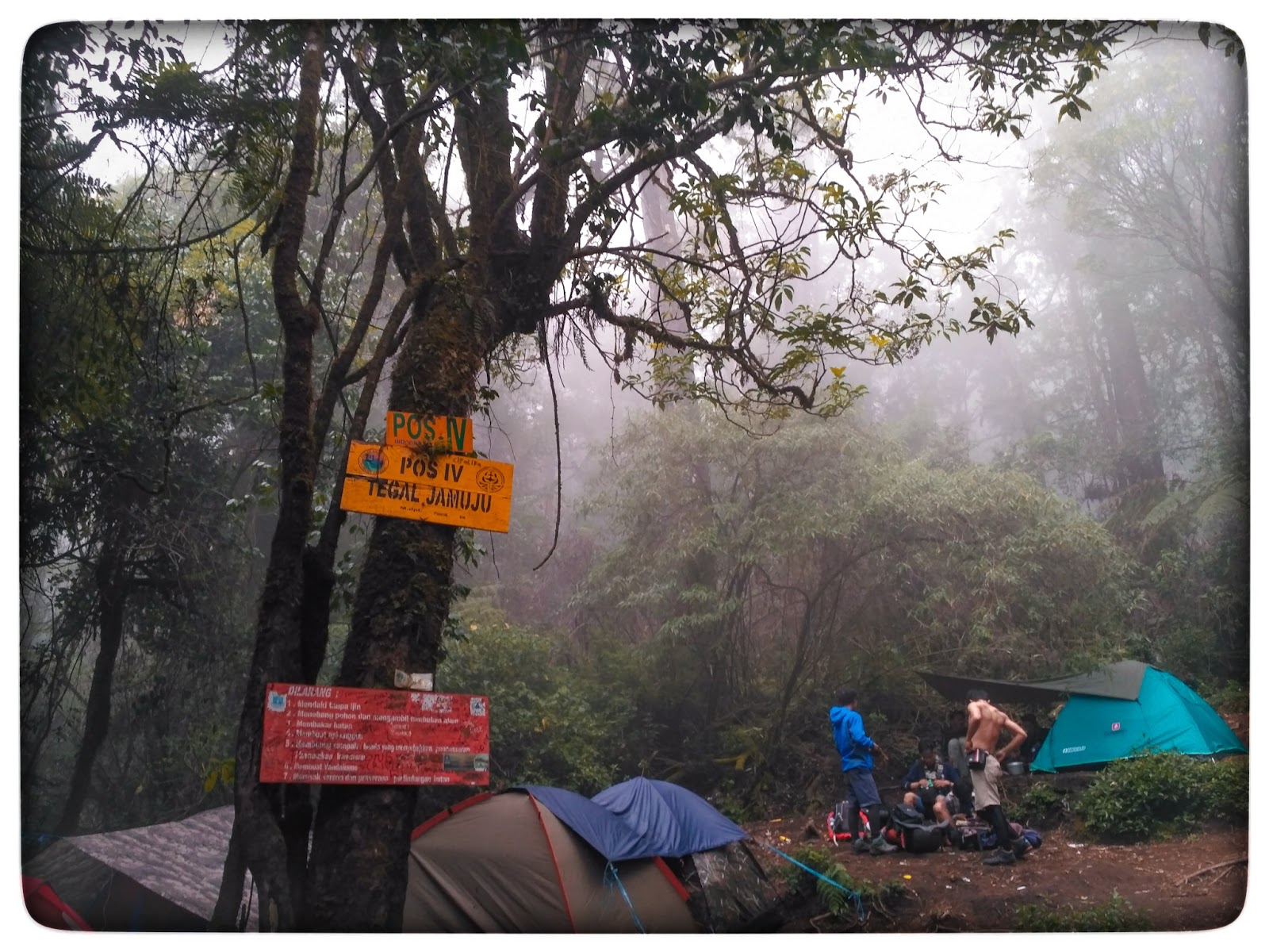
Pos 4 Tegal Jamuju
Lokasi yang direkomendasikan untuk bermalam
Elev 2329 m Duration 3.9 hours Calories 2,602 kcal -
03

Puncak
Foto: Fajar Rumawi - googlemap (September 2023)
Elev 2818 m Duration 5.6 hours Calories 3,785 kcal -
See full segmentation
Elevation profile, distance & time for each segment
Weather Conditions
Forecast at official points
Apuy
1,166 m
Tuesday
21 July · 13:00

Fog
21 °C
11.5 km/h
Wednesday
22 July · 13:00

Cloudy
22 °C
12.7 km/h
Thursday
23 July · 13:00
Fog
21 °C
15.5 km/h
ⓘ The weather conditions above are data from Open Meteo
See 7-day forecastInformation
Details you need to know
- Hiking trail status: OPEN (26-02-25)
- As of today, there is no new information about hiking and volcanic activities through this route (26-02-25)
- Water sources on the Apuy hiking trail to Mount Ciremai are very limited. Hikers are advised to stock up on water at the Apuy basecamp or at Post 1 (Cigowong), as there is no information on water sources after that until the summit. (05-07-2025)
The community and visitors/tourists are advised not to approach the crater of Mount Ciremai within a radius of 500 meters (https://tngciremai.menlhk.go.id/).
ⓘ Last updated on Senin, 9 Maret 2026
Hiker Reviews
Stories from other hikers
0%
recommend · 0 hikers
Weather forecast
—
No data yet
Trail info
—
No data yet
Water source
—
No data yet
No Reviews Yet
Be the first to share your experience and review this hiking trail!
Error!
An error occurred while fetching reviews for this hiking trail.
Other routes