Hike with Care: Understanding the Hidden Landslide Risks of Volcanoes
17 Jun 2026
3 min read
58
Admin 1
Java is famous for its majestic volcanic peaks and breathtaking panoramas. However, behind this beauty and fertility, the island holds a reputation as one of the most landslide-prone regions in the world. Understanding why the ground in Java frequently shifts is not just about statistics; it is about understanding the geological character and the "health" of our mountain slopes.
A Natural Transformation: When Rock Turns to Clay
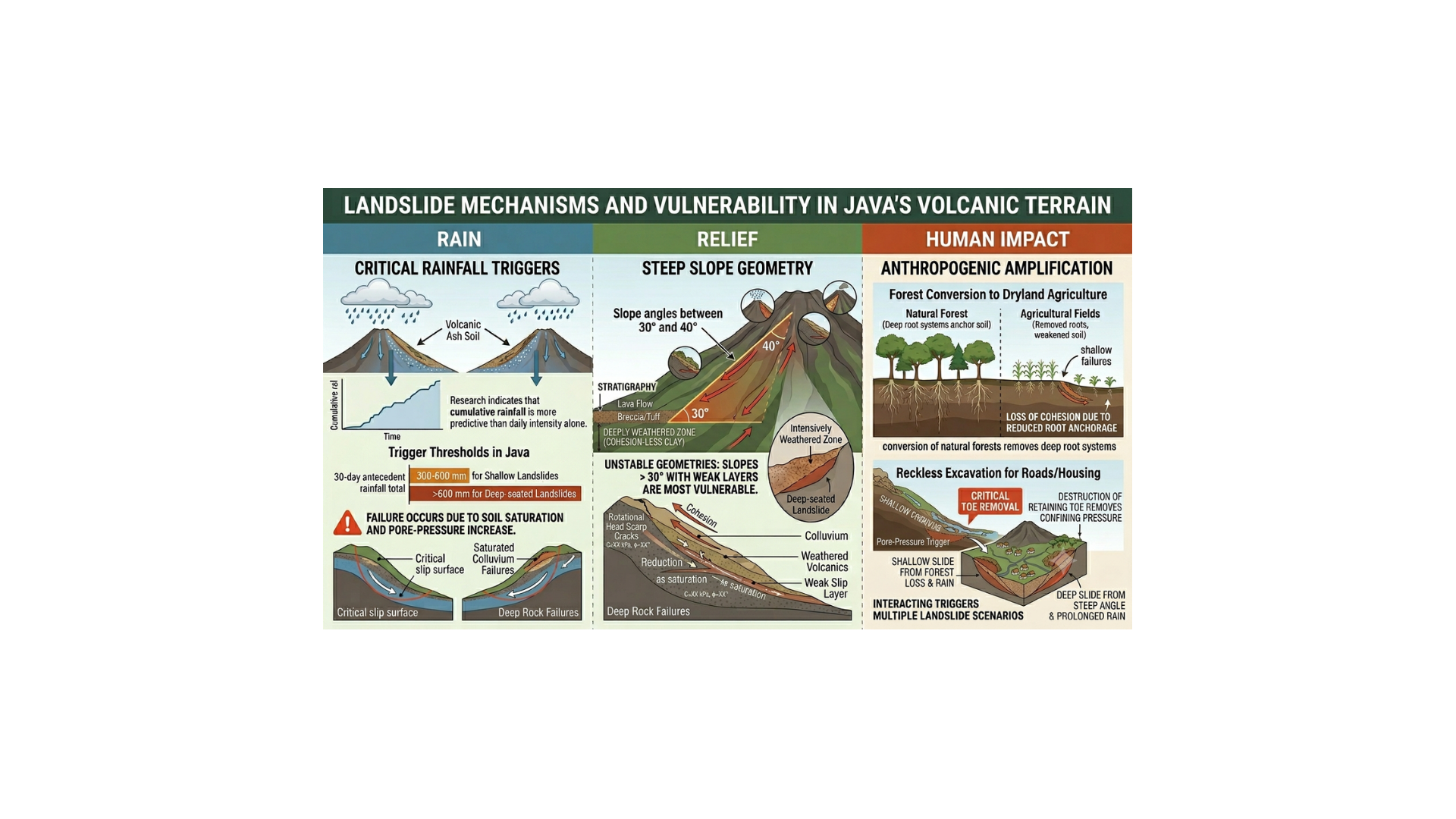
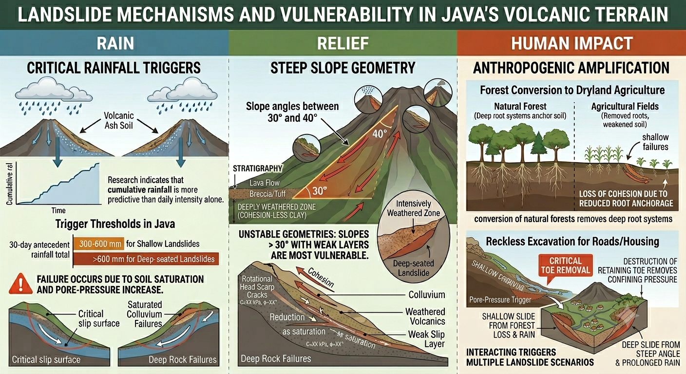
The primary cause of this vulnerability begins with a natural chemical process called hydrolysis. Because Java is located in a humid tropical region with high rainfall, rainwater constantly reacts with minerals in volcanic rocks like andesite and basalt.
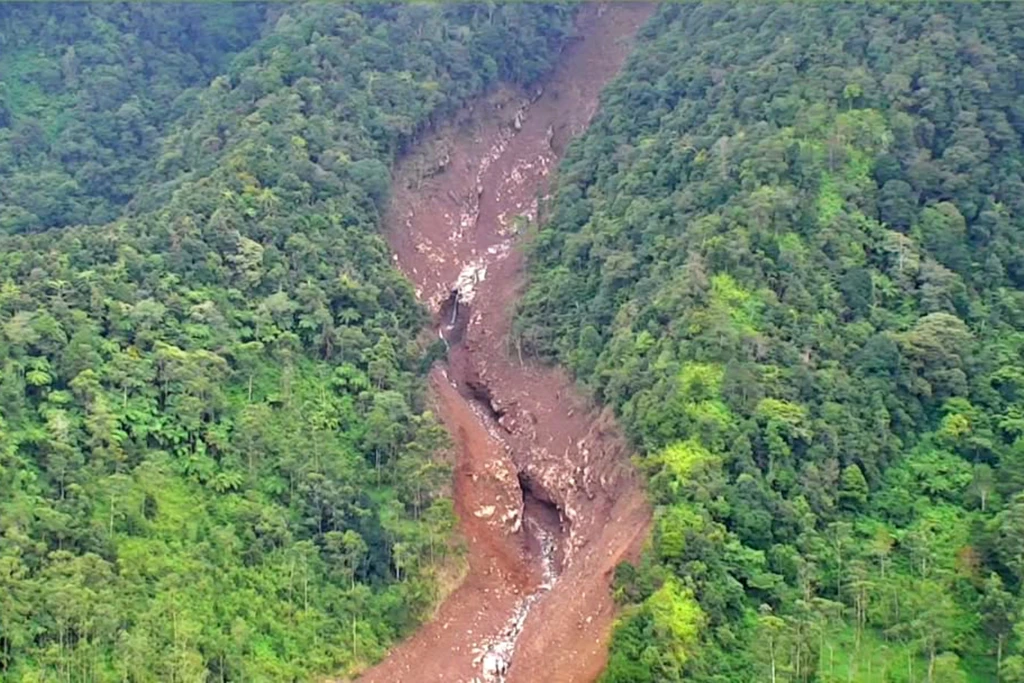
This process slowly transforms hard rock into slippery clay minerals, such as kaolinite and smectite. This transformation has a fatal impact: the soil's ability to "stick" together (cohesion) drops drastically, while its "plasticity" (the ability to change shape and flow) increases. Consequently, slopes that appear solid are often actually hiding layers of slippery soil ready to slide at any moment. Debris flow on the eastern slope of Mount Slamet volcano (Serang - Purbalingga)
Rain and Earthquakes: The Final Spark
Weakened ground needs a trigger to actually collapse. In Java, the primary trigger is cumulative rainfall. Research shows that rain falling for 30 consecutive days—with totals between 300 mm and 600 mm—often marks the danger threshold for both shallow and deep-seated landslides.
Furthermore, Java’s position in an active tectonic zone increases the risk. Earthquake vibrations often create small cracks in the rocks of the slope. While a landslide might not happen immediately during the quake, these cracks become entry points for rainwater during the next season, triggering massive failures months later.
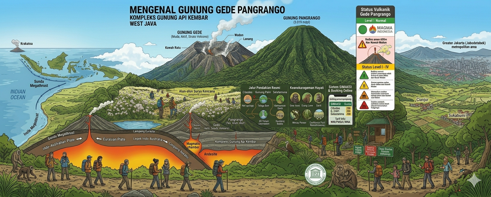
The Danger on Hiking Trails
For outdoor enthusiasts, understanding the potential for landslides on hiking trails is crucial. Most trails on Java’s volcanoes pass through zones that are geologically the most dangerous.
Critical Slope Angles: Data indicate that landslides most frequently occur on slopes between 30° and 40°. Hiking trails often traverse these exact angles as they head toward the summit.
Loose Volcanic Material: Near the top of volcanoes, trails often consist of pyroclastic material (ash and loose eruptive debris) that has not yet solidified. This material is extremely easy to wash away during heavy rain or collapse under the force of gravity.
Intense Weathering: Summits and ridges are the areas most directly exposed to heat and rain, making the chemical transformation of rock into slippery clay particularly intense there.
Water Path Risks: Trails that follow natural valleys or gullies face the additional risk of being hit by debris flows—fast-moving mixtures of mud and boulders—when heavy rain hits the peak.
Essential Tips for Hikers
Living or traveling in Java means living alongside geological risks. For hikers and communities living on mountain slopes, vigilance must be heightened when heavy rain falls for several consecutive days. Preserving forest cover and avoiding reckless slope excavation are small but vital steps to prevent major disasters in the future.